
The model and plotting library used for SkyScroll’s Arctic shading research have been made open source
SkyScroll has made the Python source-code for two of its software projects available under an open-source license, with a view to increasing openness and supporting collaboration.
SEMIAFA #
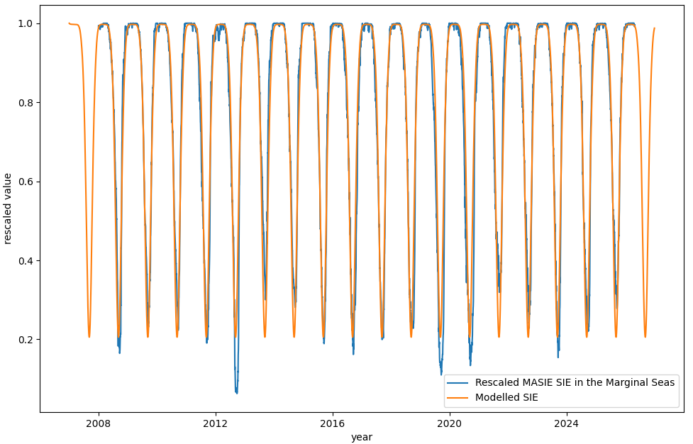
The Simple Empirical Model of Ice-Albedo Feedback in the Arctic (SEMIAFA) is a simple parameterised model of Arctic sea-ice extent (SIE) over the annual cycle. It is most relevant to the geographically bound area of Arctic Sea, and specifically the marginal seas.
It was designed to be used to for testing the order-of-magnitude impact of shading interventions, which could take advantage of the amplifying effect of the ice-albedo feedback.
The simple empirical model is configured with a limited set of parameters set-out in the table below. These parameters are optimised by minimising a cost function based on the delta between the model output and MASIE data on sea-ice extent in the relevant regions.
Shade Path #
Shade Path is a Python library used to calculate and plot the path used to target shade, or of the shade cast by a fixed sunshade, for an airborne sunshade at a given altitude.
It is used to calculate and visualise either:
- The path an airborne craft would need to follow to shade a specific point on the Earth’s surface (“Autonomous” below)
- The path followed by shade cast from an airborne craft tethered at a fixed point (“Tethered” below)
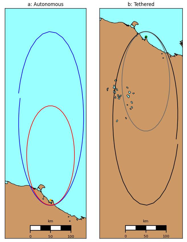
- The flight path needed for a mobile airship at 12km altitude, to keep the centre of its shadow on the target in the sea off Shelter Point, Yukon, marked with an orange dot
- The movement of the centre of the shadow cast by an airship at 12km altitude tethered at the northernmost tip of Shelter Point, Yukon, indicated by the green dot.
Feedback and Collaboration Welcome #
If you have any feedback, or would like to collaborate with SkyScroll on either of the above, please contact us.